This photograph courtesy of RCAHMS.
|
|
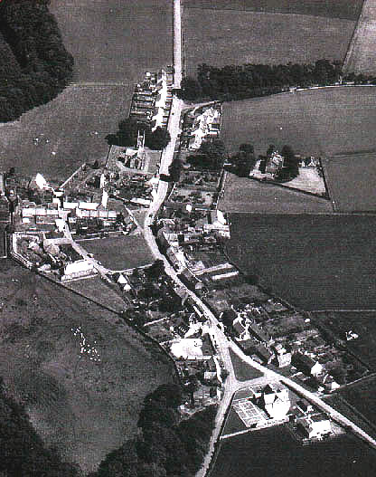
Stenton Village in a modern aerial photgraph must look esentially the same as it did in the 19th Century spread out along one the one road running through it. This view is looking aproximately ENE. This photograph courtesy of RCAHMS. |
"STENTON, a parish, containing a post-office village of its own name, in the eastern part of Haddingtonshire. It consists of two mutually detached districts, a southern and a northern. The southern district lies wholly among the Lammermoors. with a declination southward to the Whitadder; and is bounded by Berwickshire, by Whittingham, and by the Lammermoor sections of Dunbar and Spott ... The parish was originally and long called Petcox, from the village of that name; and seems to have acquired the designation of Staneton, or Stonetown, from the stoniness of the ground in the district round the church. In ancient times it was first a chapelry, and next a prebend of Dunbar and a rectory." from the Imperial Gazetteer of Scotland, edited by John Marius Wilson, 1868.
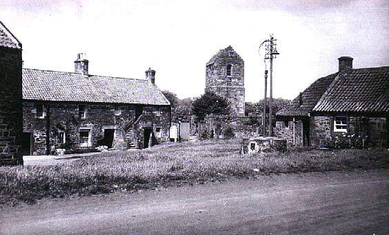
a Nineteenth century view of part of the Village.
Photograph courtesy of RCHAMS
Population:
1755 - 631
1801 - 620
1831 - 686
1841 - ??? go to the 1841 Census
1861 - 692